About
The walled city of Mayapán, known as the "Flag of the Mayas", is considered the last great Mayan capital. It has an extension of 4 km2, in which there are approximately 4,000 structures.
It dates back to the beginning of our era, reaching its maximum splendor in the Postclassical Period (1200 - 1450 A.D.). It is believed that this city had a population of 12,000 inhabitants. It was founded by the Cocom group, whom experts associate with the carriers of the so-called Mayan-Toltec culture.
It was the headquarters of "La Liga de Mayapán", a confederation that brought together the chieftains of Uxmal and Chichén Itzá. The disputes for control ended with the defeat of the Itzáes, who governed the region, and then fled to Petén, where they founded the city of Tayasal. The hegemony of the League was exercised from that moment on (at the end of the 13th century) by the Cocomes of Mayapán, although with strong opposition from the inhabitants of the other Mayan kingdoms of the Peninsula. This alliance seems to have been dissolved around the year 1440, when the Cocomes left the place and settled in Sotuta.
It is located to the south of the State of Yucatán, at kilometer 45 of the Mérida-Acanceh highway, in the same direction as the so-called “Ruta de los Conventos”.
 Mayapán
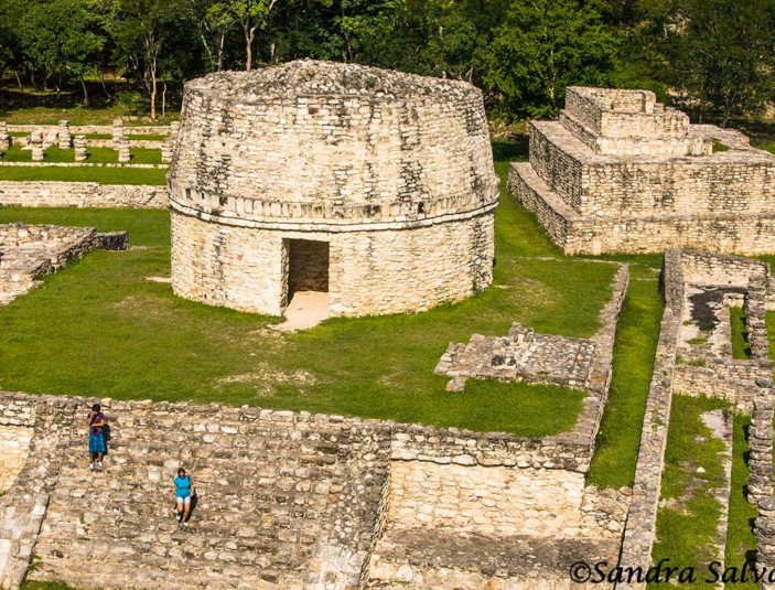
Civic, administrative, and religious buildings can be seen, as well as the residences of the ruling class. These are buildings built on foundations that have corridors with columns, temples, and oratories with an altar in the background and sidewalks.
The round buildings known as Observatories and the small sanctuaries are also representative constructions.
