
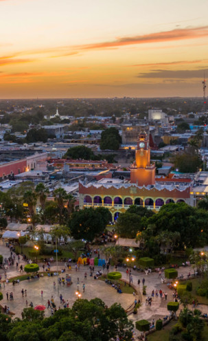
Region

The Puuc Route (puuc means "mounds") is a tour of archaeological zones that has undoubtedly become one of the favorite walks for Yucatecans and visitors to the region.
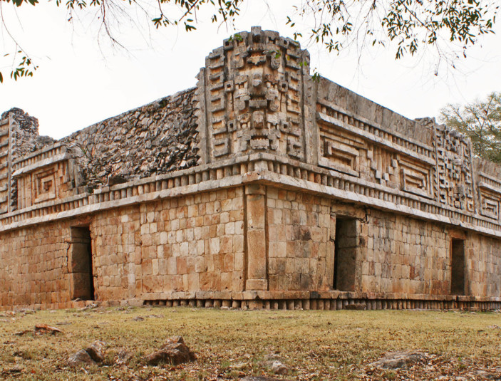
 Kabah
KabahKabah, which has name has been interpreted as "Lord of the strong or powerful hand”, is located 23 km southeast of Uxmal on highway 261, taking the detour to the right on km 16, near the city of Ticul. The importance of this city can be understood based on the fact that the Mayans mention it in the Chilam Balam, even after the Spanish conquest. Consequently, it is believed that it was as important as the one of Uxmal.
The ruins are spread on both sides of the road in a very extensive area of the jungle. They are located on the lower part of a valley, surrounded by mid-hight hills with small temples which can be seen at their summit; from the top of this hills the buildings of Nohpat and Uxmal can be clearly admired.
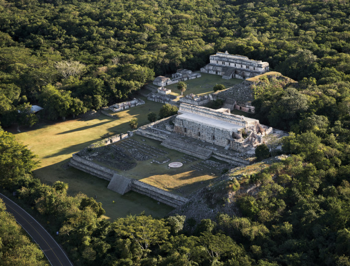
 Sayil
SayilOne of the most important settlements in the Puuc area is Sayil, considering that there were approximately 17 thousand inhabitants in this place, which explains its size and distribution. It is located 33 km southeast of Uxmal on highway 261; turn right at km 34.
In contrast to most known names for pre-Hispanic sites, this one is truly ancient. Built in a long valley, surrounded by low, somewhat rugged hills. The location is rather inhospitable, due to the lack of water on the surface. For this reason, the Maya built a large number of underground deposits or cisterns, known as “chultunes”, in order to recollect and store rainwater.
Literally, it means "Place of the Arriero ants". In the Mayan language, the word “say” is used to make reference to this species of insects that usually cut and carry pieces of leaves.
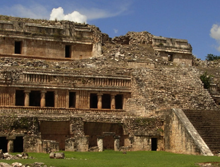
 Xlapak
Xlapak belongs to the Puuc region which had its golden age between 600 and 1000 A.D. Like most of the inhabitants of the Mayan area, the ones of Xlapac were dedicated to growing crops, building chultunes (cisterns) and watering holes to recollect rainwater. They were deeply religious and worshipped Chaac, the rain god, on whom they relied on for their livelihood.
It is a site where important Mayan buildings have been gradually discovered. The is one that stands out for being richly decorated with masks of the god Chaac (god of rain and/or water). Wandering around it and discovering its archeological jewels is a real delight for the visitor.
Xlapak is located 38 km southeast of Uxmal on highway 261 and connects to the state highway 31 on the left. This area has a craft store to buy souvenirs.
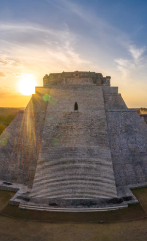
Uxmal -surrounded by legends, myths and anecdotes- is truly poetic, both in its name and history. It is located in the Santa Elena Valley next to a series of hills known as Puuc, which in Mayan language means "mountain range". Its name was then given to this architectural style to the buildings in the region.
It is estimated that it had a population of nearly 25 thousand inhabitants, distributed in a territory of 37.5 square kilometers. It had enormous agricultural potential, but lacked permanent sources of water, which explains why the Mayans constructed Chultunes, or water deposits, and a complex system of watering holes and bukteoobob, to recollect rainwater efficiently.
The occupation dates back to 500 B.C. However, during the nineth and twelfth centuries A.D. it was the center of peninsular Mayan political and economic power in the Puuc region.
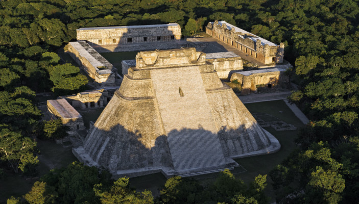 Uxmal
UxmalLoltún is located south the state, where evidence of human settlements dating from 400 to 700 years ago have been found. Its name in Mayan stands for "Stone Flower". It is the name of unique caves which have formations and some geometric shapes that catch the attention of both locals and foreigners.
Another interesting attraction are the cave paintings: on one wall you can see hands in negative, on another one you can find more elaborated paintings that represent faces, animals and staggered fretwork.
In the gallery there is an enormous vault known as the Cathedral. Along the tour you can see colorful displays of light and shadow, produced by the entrance of the sunlight through various cavities.
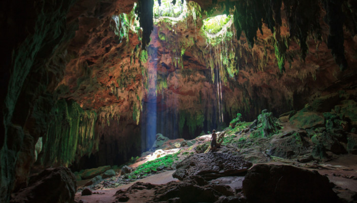 Grutas de Loltún
The Mayans used it both to extract clay to make their utensils and, as a religious center and shelter.